|
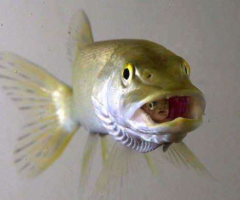
*This trout is not in his
'Happy Place!'
|
|
Conservation News & Reports
"When you put your hand in a flowing
stream, you touch the last that has gone before and the first that is still
to come"
- Leonardo Da Vinci
|
|
Dwaas Kill
&
Dwaas Kill Update
|
|
Activities Map
|
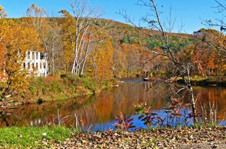
The Batten Kill near Rexleigh Bridge |
Batten Kill Cleanups for 2014
Schedule.
April 19
June 21
August 9
September 20
Thanks for all your help!
See you in 2015!
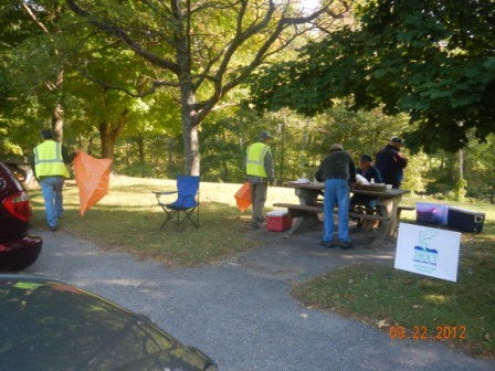
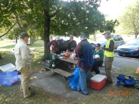
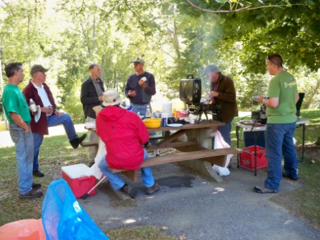
Clearwater
Chapter adopted a ~3 mile stretch of
Rte 313 next to it's home water, the Batten Kill, and 4 times per year we’ll spend an hour or so picking up roadside
debris then enjoy a picnic afterwards with our friends from the
Batten Kill Conservancy.
We meet at
9 AM at the
Rte 313 rest area
Please
join us for a nice walk, some easy work, time with old & new friends, and
refreshments provided before and afterwards.
(Plus,
maybe some members will be willing to share their ‘secret’ spots on the
Batten Kill to those who participate…).
View Larger Map |
|
  |
|
TU CHAPTERS
PARTNER IN STATE PARK STREAM PROJECT
December 13, 2014
by Greg Cuda and John Braico, edited by Roy Lamberton and Patricia O’Hanlon
A stream restoration project using natural stream
design was completed in 2014 on Geyser Brook in the Saratoga Spa State Park
(Park), in Saratoga Springs, New York. Geyser Brook runs through the
beautiful picnic area of the Park, and is fed the cold clear water of
numerous artesian springs (not really geysers).
Representatives of the Clearwater Chapter of Trout Unlimited (Clearwater TU)
were invited to review the potential for stream habitat improvements back in
2013. Following successful discussions with the Park and the City of
Saratoga Springs, the City provided Clearwater with $35,000 to fund the
proposed stream habitat work. Clearwater volunteers were then responsible
for managing the project. The project’s fish friendly outcome has exceeded
everyone’s expectations: aesthetically and functionally.
The project was designed for TU by Carl Schwartz of the US Fish & Wildlife
Service, Partners for Wildlife Program, without cost. Essential site data
was surveyed by TU volunteer members of the Adirondack and Clearwater TU
Chapters, under the direction of Dr. John Braico, president of the
Adirondack Chapter. John also prepared the plans for the project which were
used by the Park to obtain required stream modification permits from the NY
State Department of Environmental Conservation.
A noteworthy element of the project was the City of Saratoga Springs level
of confidence in the Clearwater Chapter of TU, and the volunteer members
from the Clearwater and Adirondack TU Chapters, to hand the money over to
Clearwater to manage the project. Clearwater has a history of many years of
successful stream projects through partnerships with federal, state and
local agencies, other TU chapters, TU State and National, and local
grassroots watershed organizations. The Clearwater and Adirondack TU
Chapters are fortunate to have volunteer members with expertise in field
evaluation, design, and management of projects. The chapters often also
participate in funding. This makes TU an effective partner and leader in
natural stream design improvements.
The project was managed by volunteer Greg Cuda, member and past president of
Clearwater TU, on behalf of his chapter. This included coordination of
activities with Park staff, procurement and transportation of materials,
contractor scheduling, and arrangement for payment for work and materials.
John Braico was a major contributor to some of these activities.
The hard work and dedication of many TU volunteers contributed to the
success of this project. Members of the two TU chapters were present each
day during construction. John Braico donated much of his time to oversee
construction by the contractor. The Park provided material, transportation
of material, and a staging location. Carl Schwartz of USF&WS often visited
to review implementation of his design.
As construction progressed, the enthusiasm of the partners grew and
additional habitat structures were installed. This resulted in cost overruns
which were funded by the two TU chapters, and with additional equipment and
materials provided by the Park without charge.
The completed work has resulted in 1200 feet of improved stream habitat
consisting of 5 deep scour pools, 3 under-bank structures, extensive arrays
of boulder clusters and 2 turning vanes. What was previously a largely
barren and shallow stream now bubbles over boulders and plunges into knee to
thigh deep pools. The stream has been nudged into a narrower and deeper
shape which results in faster currents and cleaner bed, a much better
habitat for trout and other aquatic wildlife. The natural stream design used
by Carl Schwartz of the USF&WS not only functions well, providing habitat
for trout, but looks natural without evidence of human activity.
Each year, over a thousand trout are stocked in this small brook under a
very successful Park program involving hundreds of area youth, each carrying
trout in their own bucket from the NYS Department of Environmental
Conservation stocking truck to release in the stream. Due primarily to lack
of suitable habitat, the majority of fish do not survive into the fall. The
partners agree that the ultimate goal will be to improve habitat
sufficiently to allow a naturally sustained population of trout. More work
will be needed in the future, but this year’s effort is expected to improve
the fishing next year. The Geyser Brook Project will help Park visitors,
adults and children alike understand the importance of aquatic habitat when
they again stock the stream next spring. They will be able to fish the rest
of the season with a healthier population of surviving trout. Some day, they
may even be able to catch trout that were born wild right in Geyser Brook.
Park Naturalist Casey Holzworth sees the restoration as a perfect
demonstration project to educate both the public and professionals
interested in natural stream design restoration. The Park and TU are excited
by the exceptional opportunities for education about healthier trout
streams, recreation, environmental stewardship, and newly created fishing
opportunities. Next year, TU volunteers have been invited to participate in
the spring kids’ trout stocking program and provide information about the
project’s design and benefits. |
|
Handicap Accessible Areas in New York State
New York State abounds in accessible by wheelchair areas
to hike, bird watch, fish or generally just get away from it all. Below
are three links with hundreds of places persons who find it a little
tough to get around would enjoy immensely. Take a moment this summer to
take a person with mobility issues out for a bit of nature. You and they
will be glad you did.
Accessible Recreation
Locations by County
Accessible Recreation
Area Maps
Fishing Access for Anglers with Disabilities
|
New Maps for Places to Fish in
North-Central NY Available.
Thirteen new maps have been added
to the
North-Central New York Public Fishing Rights (PEF) Maps() web page.
These new maps will help guide anglers to trout fishing streams
throughout DEC's Region 6, covering Herkimer, Lewis, Oneida, St.
Lawrence, and Jefferson Counties. These areas called Public Fishing
Rights (PFRs) are permanent easements purchased by the DEC from
willing landowners, giving anglers the right to fish along stream
banks on the landowner's property. Visit the
NYS DEC PFR Maps
webpage to find other available PFR locations in the State.
|
|
Get Your
Free I FISH NY Freshwater Fishing Map Today
Available for your next freshwater fishing excursion
is our new, colorful map brochure with fishing information on more than 400
lakes, ponds, rivers and streams in New York State. One side of the foldout
shows locations of some of the best fishing waters in the state, while the
other side provides details on each site, including access points, types of
fish, marinas and campsites and other important information.
To receive a map in the mail, send an e-mail request
with "NY Fishing Map" as the subject to
fwfish@gw.dec.state.ny.us.
Remember to include your name and complete address in
this e-mail. |
|
Dwaas Kill
Update
Temperature Monitoring of DWAAS KILL / BEAR BROOK
Clifton Park, NY
Attached is
the final report submitted to the Town of Clifton Park which was to
monitor the effects of storm water runoff
into Bear Brook and the impact on wild brook trout known to be present and
spawn in the stream. The headwaters of Bear Brook receive storm water runoff
from Shopper’s World, a complex with approximately 22 acres of impervious
surface consisting of parking lots and flat roof tops.
Final Report in PDF format
Get Free
Adobe Reader
to view Acrobat .PDF files |
|
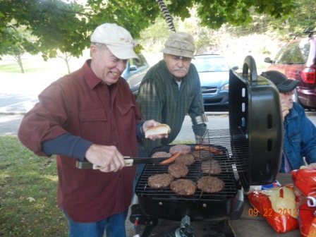
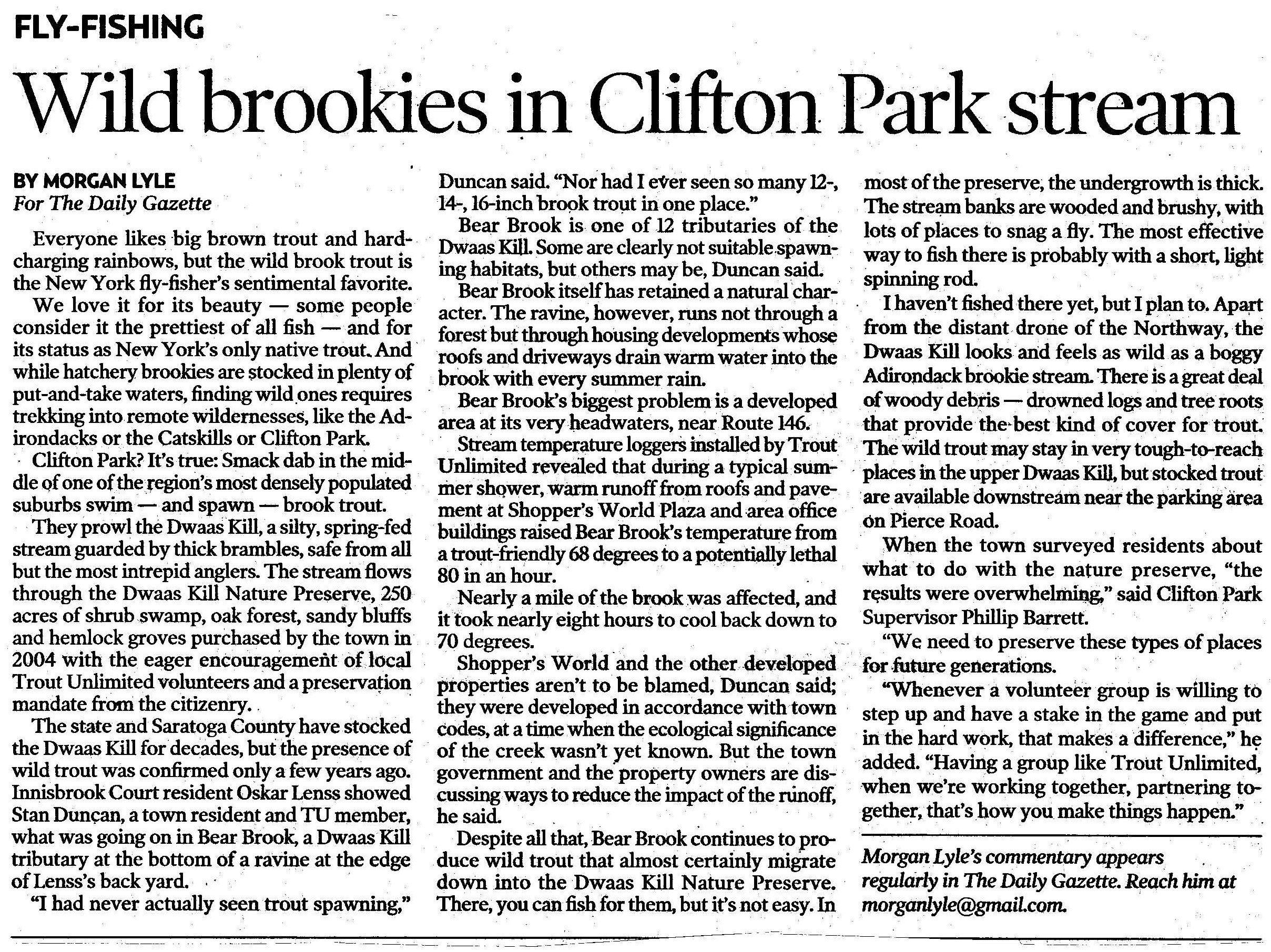
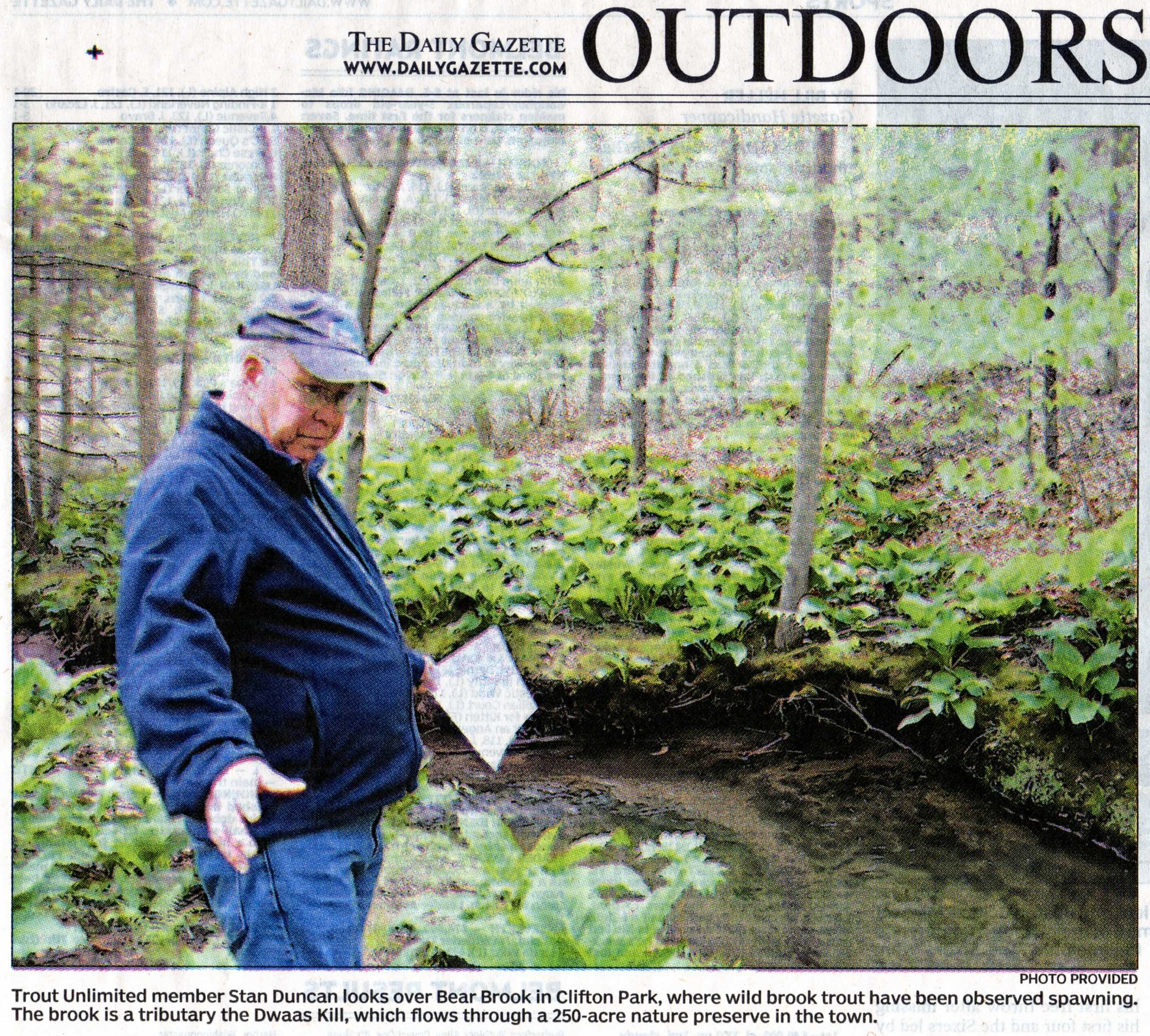
Article from
Daily Gazette in Schenectady about Stan Duncan's work on Dwaas Kill in
Clifton Park, NY.
  |
|
Dwaas Kill:
In 2006 the Town of Clifton Park purchased 250 acres of land and
designated it as the Dwaas Kill Nature Preserve. The Dwaas Kill contains
wild brook trout and runs about 1.3 miles through the Preserve. Spawning
brook trout have been observed. In 2008 the Town of Clifton Park Open Spaces
Committee began the process of developing a Master Plan for future use of
the Preserve and a consultant was hired to assist in the planning. The
Town has indicated a desire to maintain the Preserve in its present wild
condition and use it for public education. The Clearwater Chapter was
invited to assist on trout fishery issues. The Master Plan is to be
completed by early 2009.
During 2008, chapter volunteers and DEC surveyed the stream and some
tributaries, and documented brook trout spawning. Several culverts have been
identified as potential barriers to fish migration, water quality and storm
water management issues have been observed, and riparian plantings are
needed in some areas to stabilize some banks. Recent temperature monitoring
data obtained by TU volunteers is being retained and evaluated at the
Saratoga County Soil and Water Conservation District. This is a unique
opportunity to reserve a wild brook trout fishery in the middle of a highly
developed section of Clifton Park. It is also an outstanding example
of community planning through the joint efforts of the Town, County,
NYSDEC and volunteer organizations such as TU.
Download CD ready Power Point presentation & Viewer of Dwaas
Kill Nature Preserve Project.
Zip file: ~25 MB
download.
Spawning Trout Videos in Dwaas Kill (Windows Media
Player *.avi format)
Video1
Video2 |
|
NYS DEC Hudson River E-Almanac
The Hudson River E-Almanac is compiled and
edited by Tom Lake and emailed weekly by DEC's Hudson River Estuary Program.
To sign up to receive the E-Almanac
(or to unsubscribe) and write E-Almanac in the subject line.
Weekly issues Archives.
The DEC website's search engine can find species, locations, and other data
in the archives.
Conservationist
magazine brings nature to your door. Discover New York State Conservationist
- the award-winning, advertisement-free magazine focusing on New York
State's great outdoors and natural resources. Conservationist features
stunning photography, informative articles and around-the-state coverage.
For a free, no-obligation issue go to
Conservationist
Magazine.
Information on the movements of the salt front in the Hudson estuary is
presented by the
U.S.
Geological Survey.
For real-time information on Hudson River weather and water conditions from
eight monitoring stations, visit the Hudson
River Environmental Conditions Observing System website .
Information about the Hudson River Estuary Program is available on
DEC's website.
Copies of past issues of the Hudson River Almanac, Volumes II-VIII, are
available for purchase from the publisher,
Purple Mountain Press, (800)
325-2665. |
|
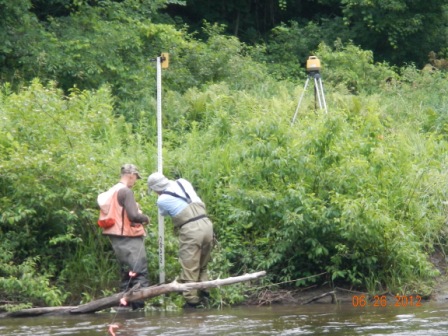
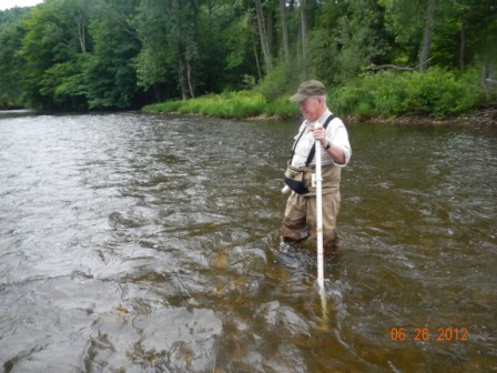
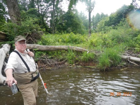
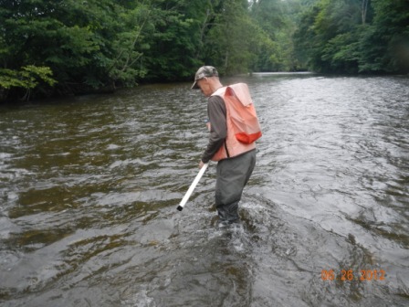
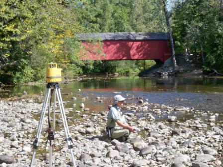
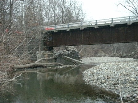
Batten Kill
Survey near Route 313 bridge.
Participating in the survey were Art Coleman, Stan
Duncan, Ron Bellisario and me. This survey should give sufficient data for
the start of structure installation in that portion of the river by US Fish
and Wild Life Department, Carl Schwartz and his team. |
   |
|
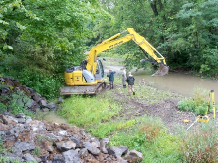
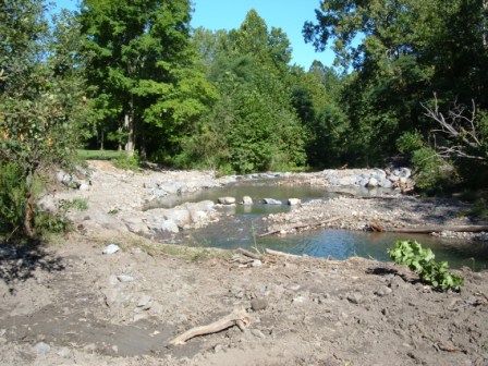
Batten Kill Hi-Brow (Skellie) Farm Site Habitat Restoration:
The Chapter initiated this habitat restoration project on the Batten Kill
River in East Greenwich to remediate damage from prior flooding. The river
had split into two channels which were over widened and shallow. The goal is
to put the river into its original channel, then add cover and shelter to
this reach of river. The channel also needs to be narrowed in sections, and
this work is scheduled to be completed in 2009. In 2008 a rock
structure was built to cutoff one of the river channels and redirect the
river. Several wood vanes were added to the pool above the cutoff adding
cover and shelter for trout. The pool was substantially deepened as the
result of the structure. The bench was built to bank full height to provide
the river access to the farm field during a flood event.
The work was funded by the Clearwater Chapter of Trout Unlimited and the
Batten Kill Watershed Alliance. Technical assistance was provided by Art
Coleman and Dr. John Braico of Clearwater and Adirondack TU chapters,
respectively. Design and implementation was provided by Carl Schwartz with
the US Fish and Wildlife Service. Hi-Brow Farms contributed rock and
trees for the project. The projected work for 2009 includes adding
more large woody debris to the pools reaches, and building rock vanes to
narrow and deepen the river where needed. We have a commitment for trees,
rock and the use of an excavator from Hi-Brow Farms.
This work is continuing through 201 4 |
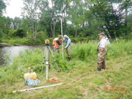
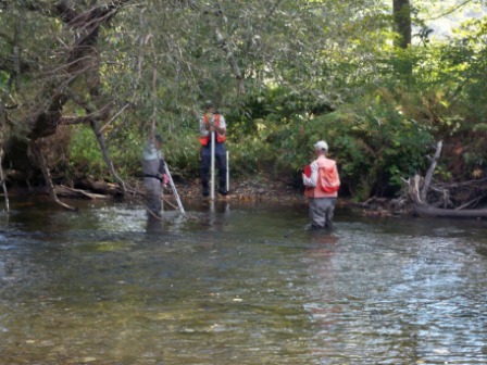
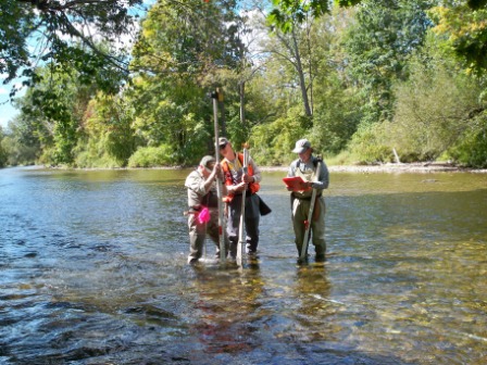
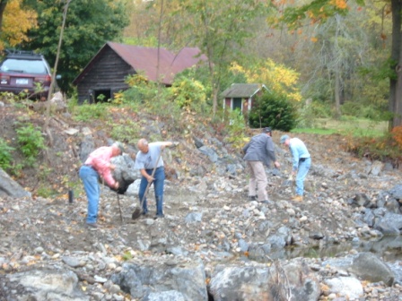
Members
of the Adirondack and Clearwater Chapters doing a survey on the Batten
Kill River just below the Eagleville Bridge on September 20, 2010
The team was performing cross sectional
profiles of the stream every 100 feet for a distance of about one half
mile. The information is provided to US Fish and Wild Life for design
of structures to provide habitat and redirection of the stream. The
steam is presently too straight, wide, shallow and provide little if no
safe habitat (protection) for trout.
This work is a continuation of work
that has been completed just above the bridge and work further up stream
at the picnic area just below the Vermont State Line.
|
   |
|
Batten Kill Luty Site:
With USF&W, we looked at an eroding bank threatening a
summer home and provided advice to the homeowner.
|
|
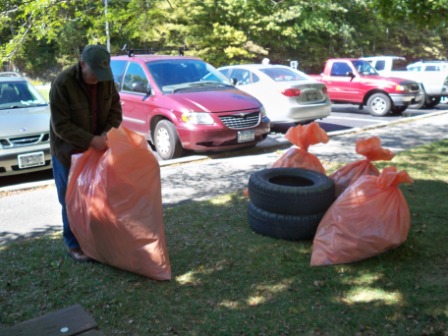
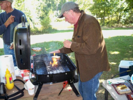
Roadside Cleanup:
We perform four highway cleanups on Route 313 along the Batten Kill,
partnering with the Batten Kill Conservancy for 4.5 miles of roadside.
|
|
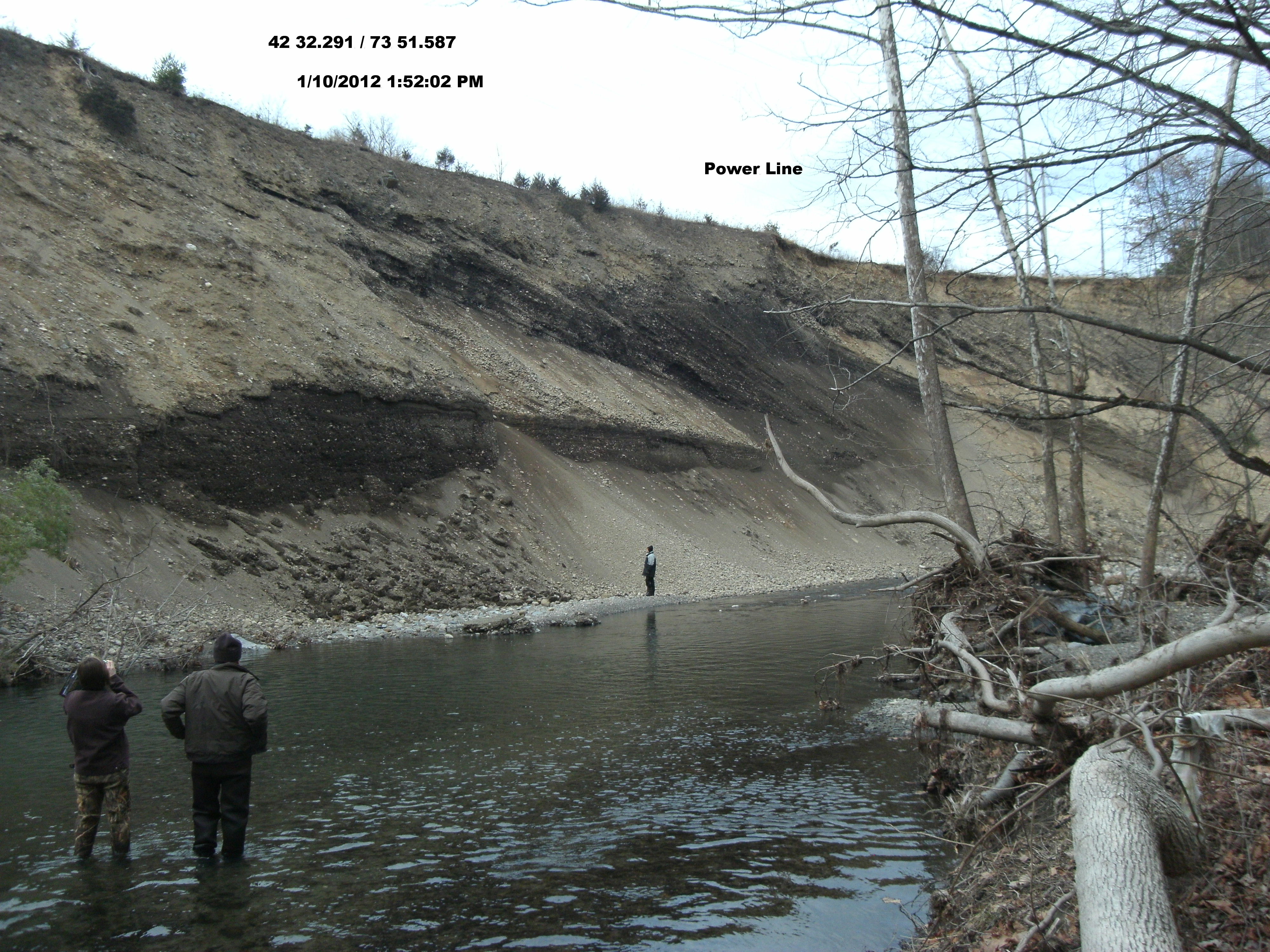
Onesquethaw-Coeymans Creek
Below is a photo of the largest unstable
bank Carl Schwartz (USF&WS) has ever seen, on tiny Onesquethaw Creek in
Albany County. This is in a newly proposed PFR (public fishing rights)
stretch, and there are plans to stabilize the toe. But the power line's days
are probably numbered. The person in the photo left immediately after the
photo, as the rocks were falling as we stood there. It would be interesting
to know how many tons of sediment from here wound up in the Hudson River
during Hurricane Irene.
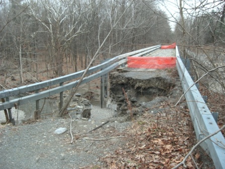
Other pictures of recent flood damage
on the Onesquethaw Creek
|
|
Pictures from Barber Stream Restoration and Bank Stabilization Project August 2010
|
   |
|
Ten Mile and Catskill Creeks:
Ten Mile Creek is a tributary of Catskill Creek, and
both contain wild populations of rainbow trout. Clearwater volunteers are
talking to members of the Columbia-Greene TU Chapter and the Greene County
Soil and Water Conservation District regarding joint efforts on the creeks.
Catskill Creek has its headwaters in Schoharie and Albany Counties, and its
tributary, Ten Mile Creek, begins in Albany County.
|
|
Hudson River Watershed Alliance:
A Clearwater volunteer is representing the Onesquethaw-Coeymans Watershed
Council and Trout Unlimited on the steering committee of the
Hudson River
Watershed Alliance. The mission of the Alliance is to protect,
conserve and restore the water resources of the Hudson River Basin through
collaborative outreach, education, networking, science, information sharing
and technical assistance by and for the stakeholders of the region. The work
of the Alliance will be a strong resource for TU chapters as well as
decision makers. |
|
Map of Clearwater Conservation
Project Areas:
 |
|